Geospatial
Case Studies
Case studies show our precision mapping prevents costly rework and extends asset lifecycles through millimeter-accurate data collection in complex environments.
Geospatial Case Studies
We’re building a greener tomorrow. Our solutions optimize operations, cut waste, and lower emissions, supporting net-zero goals. Internally, we use renewable energy, reduce travel with digital tools, and partner with eco-conscious suppliers.

Geospatial Services
Utility Mapping & Detection
Eliminating subsurface uncertainty with advanced ground penetration radar and electromagnetic detection technologies. Our comprehensive 3D utility mapping provides complete visibility of underground infrastructure
Zero
95%
100%

Geospatial Services
Geospatial Mapping
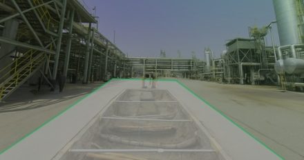
Revolutionizing large-scale topographic mapping with advanced mobile LiDAR technology. Our rapid deployment solution captured 19 million square meters of complex terrain in record time, delivering centimeter-accurate data for critical infrastructure planning.
4 Weeks
80%
100%
Learn More About Our Impact
Discover how our sustainability efforts drive value for clients and communities.