Success Stories
In-depth insights from our successful projects and the measurable impact we've delivered for our clients
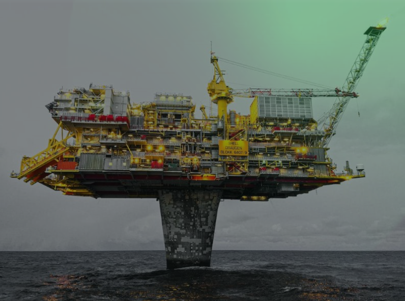
Precision Geodetic Monitoring
Millimeter-accurate subsidence monitoring across 35 offshore platforms using advanced GNSS technology and international reference frames. Our exacting survey approach achieved sub-centimeter precision over 100km baselines for critical infrastructure integrity management.
1. Challenge
A massive offshore oil field comprising 35 platforms—including wellheads, processing complexes, and utilities interconnected by thousands of kilometers of pipelines—required periodic subsidence monitoring with millimeter accuracy. The extraordinary challenge was the absence of any physical reference within the oil field itself, with the nearest stable base station located nearly 100km away onshore. Traditional differential GPS methods were insufficient over such distances, requiring innovative approaches to achieve the required ±3mm accuracy for detecting platform settlement and tilt as part of critical integrity management.
2. Our Approach & Solution
- International Terrestrial Reference Frame (ITRF): We utilized IGS reference stations thousands of kilometers away as our primary control, bypassing the need for local physical references and establishing a globally- referenced monitoring network.
- Long-Term Base Station Operation: Maintained continuous operation of the onshore base station for multiple months, creating a robust data set that enabled precise modeling of atmospheric and systematic errors over the 100km baselines.
- Expert Data Processing Partnership: Collaborated with the Danish Space Agency's geodetic experts to process the GNSS data using sophisticated scientific software, achieving the required sub-centimeter accuracy across the challenging distances.
- Integrated Measurement Approach: Combined GNSS positioning with sub- millimeter total stations to measure both absolute position changes and relative movements between platform structures, providing comprehensive deformation analysis.
3. Technologies & Methodologies
4. Results & Impact:
- Unprecedented Accuracy: Achieved ±3mm positioning accuracy over 100km baselines, setting a new benchmark for offshore geodetic monitoring in the region.
- Comprehensive Coverage: Successfully monitored all 35 offshore platforms, providing the operator with a complete picture of field-wide subsidence patterns and differential movements.
- Tilt Detection: Identified subtle platform tilts as small as 0.01 degrees, enabling proactive structural reinforcement before issues became critical.
- Integrity Management: Provided the definitive data needed for longterm platform integrity management, extending asset life and ensuring operational safety.
- Cost Efficiency: Delivered millimeter-accurate results without the prohibitive cost of establishing local reference stations in the offshore environment.
5. Conclusion
This project represents a pinnacle achievement in precision geodetic surveying, demonstrating GeoSoft's capability to overcome seemingly impossible technical challenges through innovation and expertise. By leveraging international reference frames, extended observation strategies, and world-class processing capabilities, we delivered millimeter accuracy where conventional approaches would have failed. The successful monitoring of 35 platforms across 100km baselines doesn't just represent technical excellence—it provides the foundation for safe, long-term operation of critical energy infrastructure. This is the exacting, quietly brilliant work that protects billion-dollar assets and ensures the safety of personnel, demonstrating that when precision matters, GeoSoft delivers regardless of the challenges.
Trusted by Industry Leaders
We partner with offshore operators and pipeline companies to deliver precision survey solutions.

Offshore Operations
Major offshore oil and gas operators trust our survey technology for critical infrastructure projects.

Pipeline Companies
Leading pipeline infrastructure companies rely on our precision mapping and underground utility services.

Engineering Firms
Engineering consultancies partner with us for accurate survey data and 3D modeling services.
IMPACT

Timeline
Comprehensive survey results delivered in six weeks.

Deliverables
Topographical drawings, digital terrain models, contour maps, longitudinal profiles, 2D & 3D underground utility maps.

Safety
Avoided potential hazards and optimized pipeline route.

Cost-Efficiency
Achieved significant cost savings and reduced construction time.

Technology
Utilized advanced tools like LiDAR and GPR.

Efficiency
Enhanced data collection and analysis processes.